The Danube is the second longest river in Europe, and its delta plays a buffering role between the river and the Black Sea. An excess of nutrients discharged into the river has caused eutrophication at its mouth since the 1970s. Most of present models are unable to correctly represent this phenomenon because of the difference in scales of the processes involved. By using SLIM, we can seamlessly represent these phenomena and evaluate the present and future risks of eutrophication on the coastal area of the Black Sea.
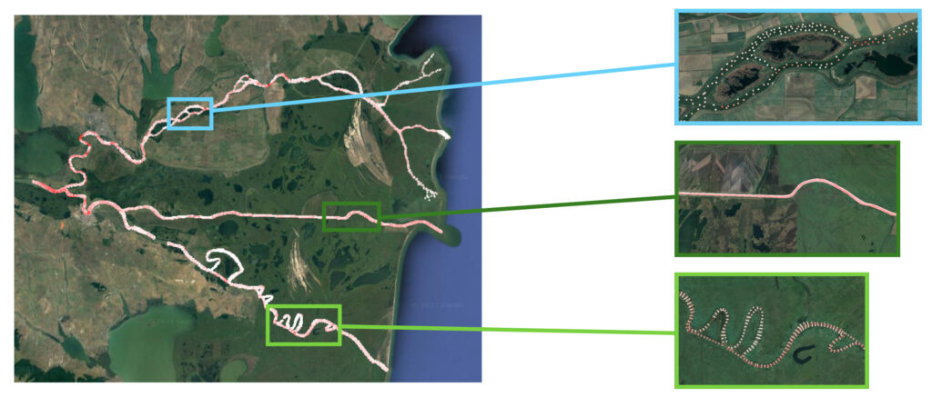
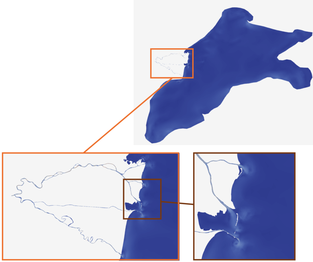
The first step to setup a model of the river-delta-sea continuum is to produce a continuous bathymetry dataset of the entire area. While the bathymetry of the Black Sea is readily available, the bathymetry of the delta is more elusive. We first had to collect the different bathymetry sources for each branch of the delta, which were provided in different formats, and then merge them together and interpolate them on the model mesh by using an anisotropic interpolation method in a local system of coordinates. Preliminary model results with the 2D version of SLIM are encouraging. Following steps will consist in taking the floodplains into account and coupling a 2D model for the delta system with a 3D model in the Black Sea.
External collaborators
Prof. Marilaure Grégoire (University of Liège) and Dr Luc Vandenbulcke (University of Liège).
To learn more…
Coming soon!